Give us some information about your work and get a personalized demo.

Real-time Collaborative Mapping
How it works?
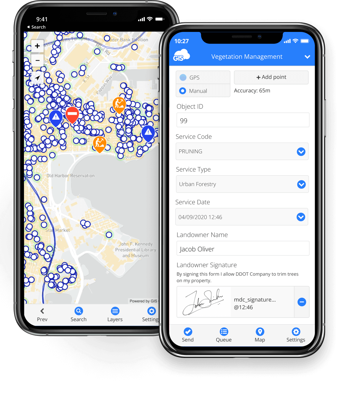
Fieldworkers
Collect data using Mobile Data Collection and report from the field
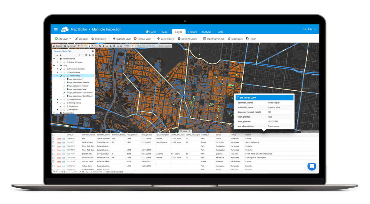
Engineers & Managers
Create maps and surveys, manage data and teams using Map Editor
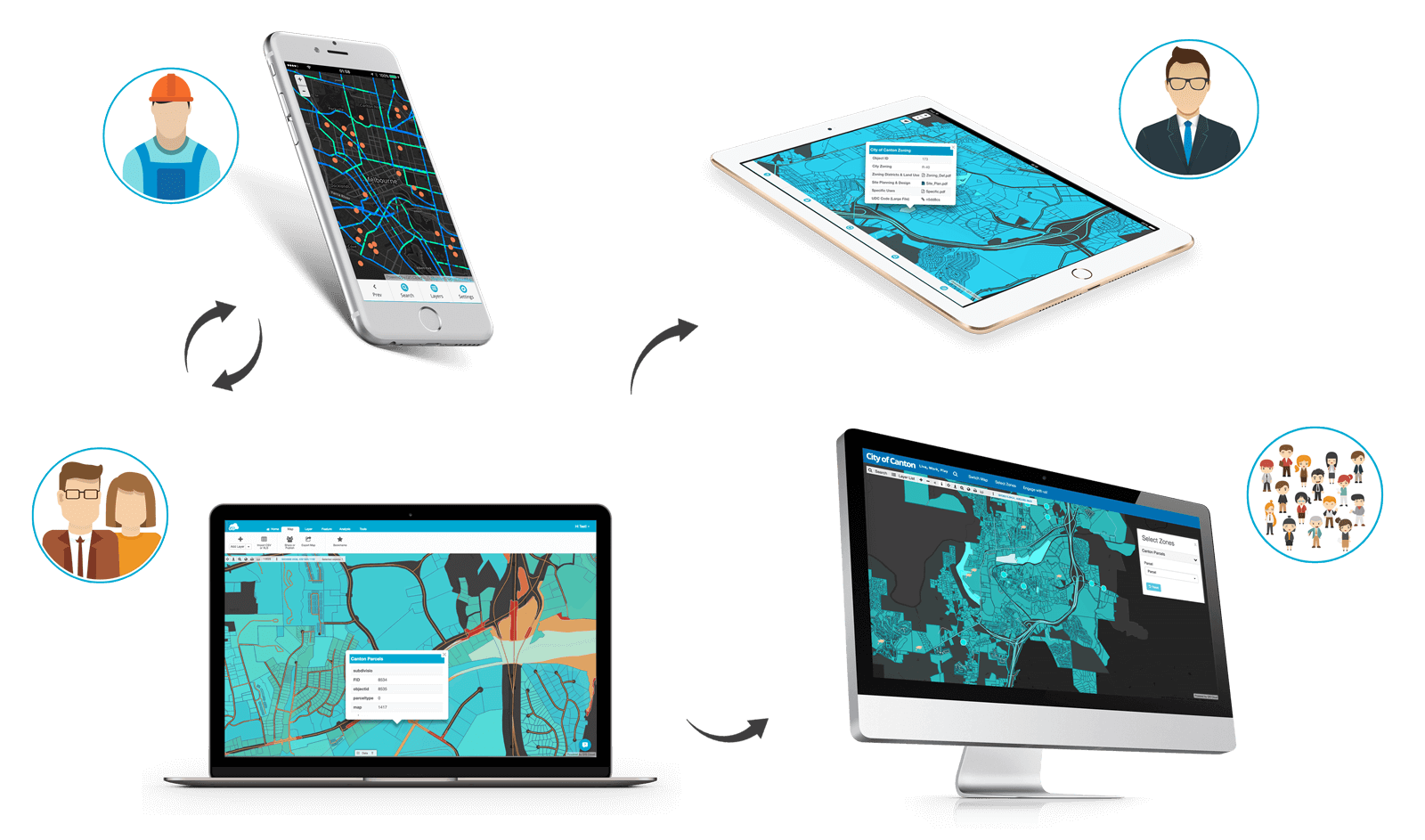
Decision Makers
Use Map Viewer to always work with accurate information
Public
Consume maps through a simple, branded Map Portal
People with specific roles use specialized apps
Sharing maps and data with specific permissions enables streamlined organization workflow and task management
CREATE, SHARE & PUBLISH MAPS
Upload your vector & raster datasets or publish data from your desktop tools.
Create, style and edit maps. Share projects and invite your coworkers to join you.
MAKE INFORMED DECISIONS
based on real-time data
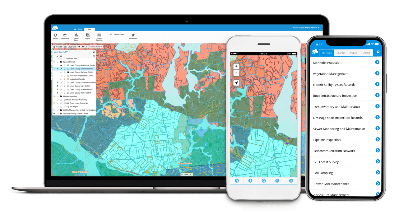
Access private maps shared with you, on mobile and web app.
Keep an eye on your projects anytime, anywhere, online & offline.
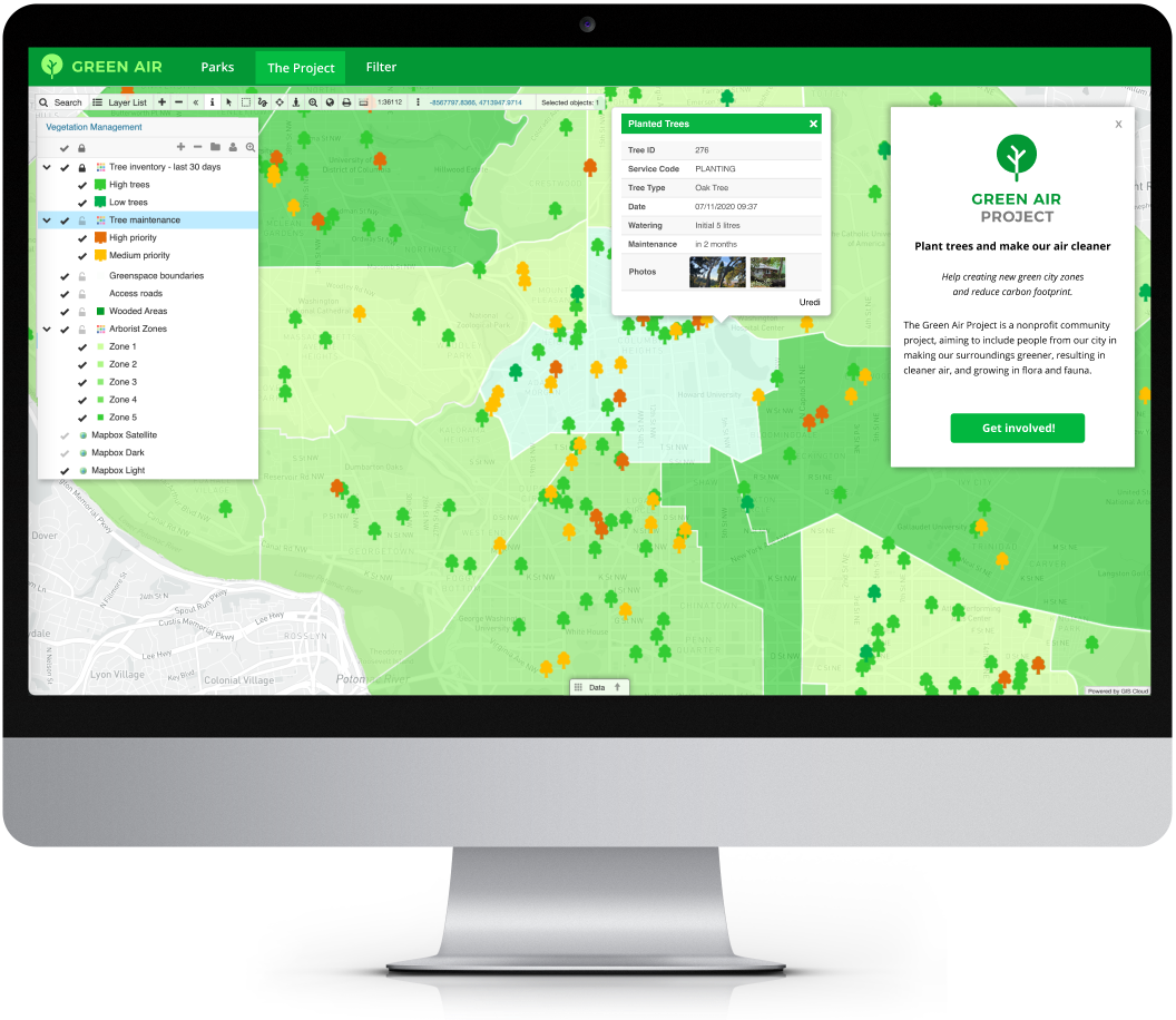
ENGAGE YOUR COMMUNITY
with a custom GIS app
Create no-code custom app and make your maps publicly available through a simple and intuitive interface.
Brand your Map Portal with colors, logo and layout, enrich maps with the search option and custom filters.
POWERFUL PLATFORM for rapid APP DEVELOPMENT

Cloud Native
A fast and robust Map Engine enables you to instantly view data on a map at an amazing rendering speed.
Build your own Apps on top of GIS Cloud, without coding. Use rich and powerful API to develop entirely
custom solutions.
Tailored for ALL BUDGETS
Transparent & straightforward pricing plans. Pay only for what you use.
We offer volume discount and up to 50% off for education & non-profit organizations.
SECURITY & PRIVATE CLOUD

Infrastructure that scales
We use Amazon data centers as our cloud servers, world-renowned for their reliability and security.
For users who prefer private cloud solutions, we offer customized installations behind ON-PREMISES firewall.
Terms of use & Privacy policy © GIS Cloud Ltd