How to ensure the quality of your projects?
To ensure the quality of your projects, it is best to keep them simple. Meaning, you should try to avoid making any unnecessary steps whether when collecting, editing or exporting your data. Below you can find some of our features that will help with this!
Table of Contents
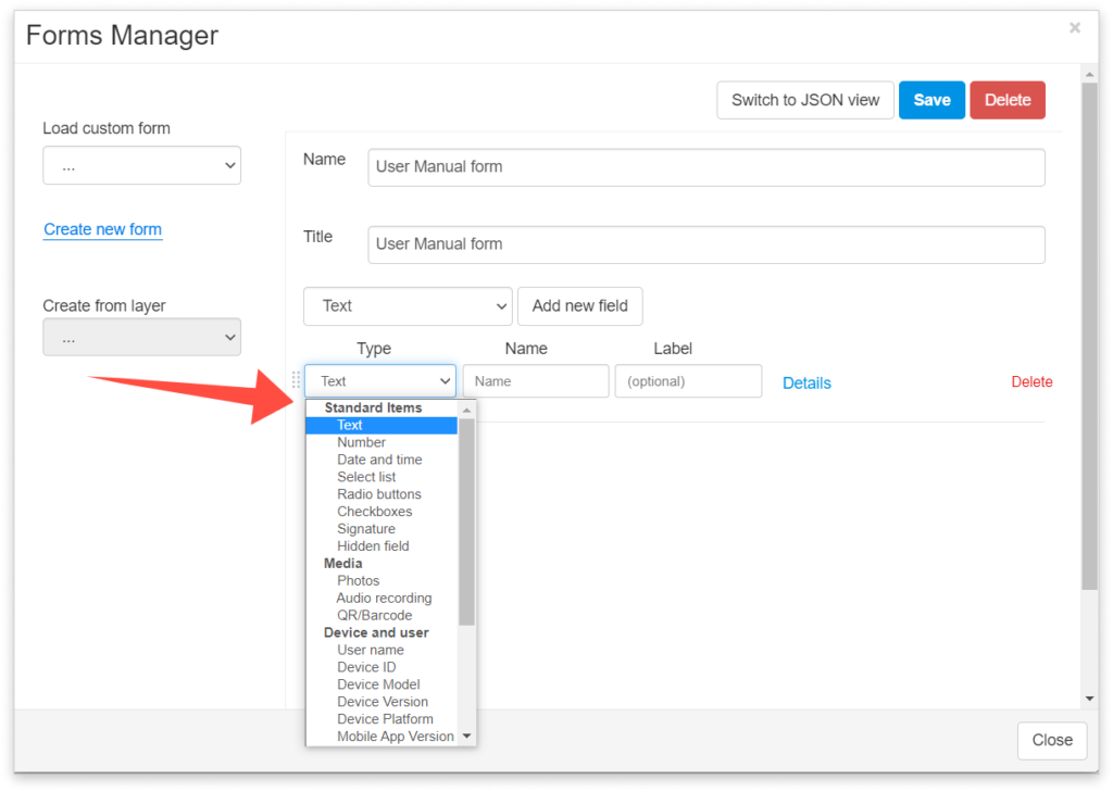
Form items
We have plenty of form item types. Here are some we think could save you or your collectors some time since they collect the data automatically.
Note that the form items below are invisible to a data collector in the field. The accuracy depends on the GPS of the device, but you can connect to external GPS to improve it.
User name – The collector’s username will be automatically added by every data submission. If the feature is edited, this field will record the username of the user who last edited it.
Hidden field – Creates a hidden field with the default value.
Accuracy – Records the accuracy of the GPS location in meters (m). It is set to 0 if the Pinpoint tool is used.
Time – Records the time when the device has submitted data (converted into the local timezone of the viewer). It refers to time information about the location of the device. For example, if GPS is used to send location data, then it refers to the time of the last received GPS location. If pinpoint is used, then it refers to the time of the last accepted point.
Latitude – The latitude of the data collected using GPS.
Longitude – The longitude of the data collected using GPS.
Feel free to check the rest of the form items here. Also, take a look at this guide if you would like to add these items in Map Editor or this guide if you’d like to do the same in Mobile Data Collection Portal.
Form options
Form options can be found in every form item you created. Here are the options we have and how you can use them to enhance your forms:
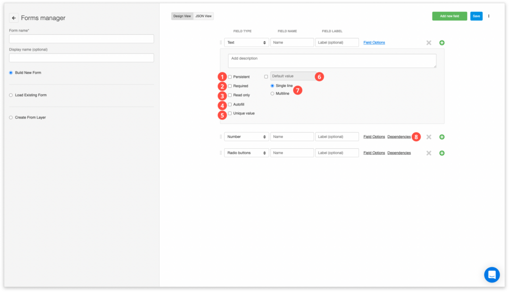
- Persistent – Normally, after data has successfully been submitted, the value of the field is reset – emptied or set to the default value. Persistent fields retain the last entered value. This way you can avoid entering often-repeated values.
- Required – Data submission will be disabled if there is no data entered in the required field. A popup warning message appears.
- Read-only – The owner of the project controls which forms fields that can be edited (input made by field data collectors), and which are in the form of static non-editable data.
- Autofill – A feature that fetches values from existing features on the map depending on your current location, it enters the value already submitted from the closest feature.
- Unique value – enabling this option prevents collecting duplicate data. Learn more here.
- Default value – Defined value will be entered in the specified column by default.
- Single line and Multiline – Option that defines whether the collector will be able to type the text in one line or multiple lines.
- Dependencies – Dependent fields allow you to manage sets of dependencies between fields. When a field is dependent it will only be available for editing and displayed if the state of the parent field satisfies the right rule. If the rule is not satisfied, it will not be possible to view or edit dependent form fields. Learn more about dependencies on form items. Also, you can create dependencies on value items as well.