
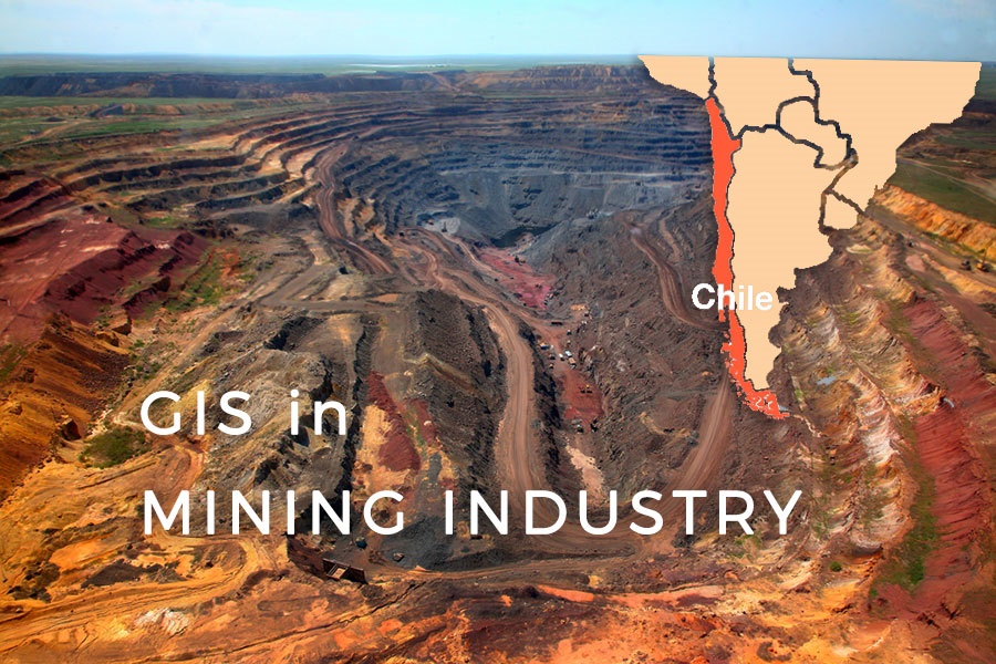
The mining industry in Chile produces more than one-third of government income by exporting Copper. Other important mining products include gold, silver, molybdenum, iron, and coal, while most of the mining products are located in the Atacama Region. At this mining region small and medium-sized mining operations make a significant part of the mining industry. These types of mines are extremely vulnerable to changes in mineral value as a sharper drop in copper value could send them over the edge. Learn how Adolfo Ibanez University and ENAMI are trying to mitigate the problem.
The project for growth and sustainability of mining in Chile
The Atacama region was in focus of the project done by Adolfo Ibañez University for the Empresa Nacional de Mining (ENAMI) and GIS Cloud Partners Teramaps – “Information platform for the diversification, growth, and sustainability of small and medium-sized mining in Chile with a focus on the Atacama Region.”
In the project presentation, it is estimated that by incorporating new minerals into the national production supply it is possible to expect an increase of 10% to 40% in mining reserves in the small and medium mining segments. The effect of valorizing more minerals would allow generating economic incentives for their extraction, which raises a significant economic benefit for the Region of Atacama, raising the mining revenues to $180 million per year.
Supporting this projection, ENAMI and Teramaps used GIS Cloud to offer easy access to all relevant information about mining in Chile to both people in the industry and a broader public via an interactive map. The goal was to provide the users with an opportunity to search, view, explore and download specific information of interest as easily as possible.
The Challenge
As this was a large project that included many different stakeholders, one of the main challenges was to enable individual contributors to add and update information about the environment, minerals, and cadastre data independently on different map layers.
At the same time, the application user interface needed to be simple and easy to use for both administrators, contributors, and end-users from the mining industry and the public. The users required to have a search option to find information quickly, and also to access particular information about points and polygons on a map such as PDF analysis of market segments for an area.
Also, the interactive map needed to provide a way for administrators to extract information about specific areas of interest using customizable reports.
Creating interactive maps from mining activity data
As the primary goal was to find the fastest and easiest way to include many stakeholders working on an interactive map that will be shared with the users and the public, the logical solution was to use cloud-based mapping software.
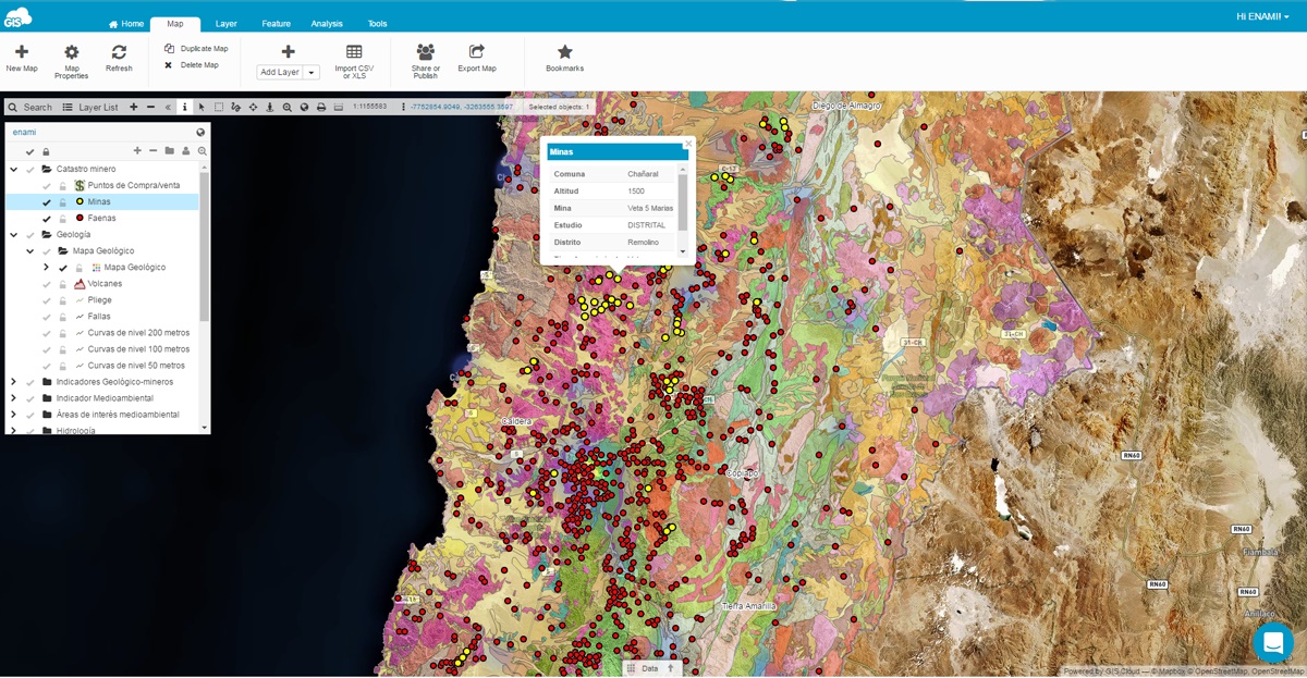
In the first part of the project, ENAMI and Teramaps used GIS Cloud Map Editor to create a thematic map that included various layers of data on top of high-resolution satellite imagery – layers provided environmental information, mining cadastre and different indicators showing mining activity in a territory. For example, the layer of prospects and mining deposits distributed in the Atacama Region was particularly interesting to end-users, as they were able to use it to search for minerals. Data was attached to different areas on a map in the form of the PDF reports which can be easily downloaded.
Data was added to a map by contributors that had different levels of access (edit, report, export and other privileges), and the cloud environment enabled them to collaborate, access and update a map in real-time. All of this was done in a short amount of time as the user-friendly Map Editor environment allowed quick and effective update and easier data management compared to desktop mapping software environment. Users were also able to create customized reports in only a few clicks, which made the communication and decision-making process more effective.
Fully customized map portal
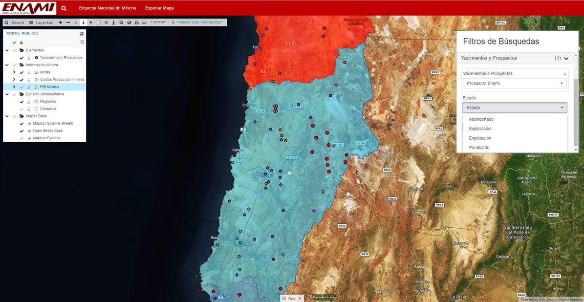
The map was published in GIS Cloud Map Portal application that provided a fully customized and user-friendly environment for the mining industry stakeholders and the public. Those who wanted to access information about mining in the Atacama Region were able to visualize data effectively through an interactive map, search for the information about minerals and particular areas of interest as well as download PDF reports in just a few clicks. The interactive map is available on the website of the National Mining Company, Enami.
Interested in GIS Cloud solutions for the mining industry? Explore the 30-day free trial or contact us.