

The District Council of Mallala, now known as Adelaide Plains Council, in South Australia, has been using GIS Cloud for over eight years.
The Adelaide Plains Council area covers over 350 square miles off the St.Vincent Gulf. Despite being a small community with fewer than 10,000 people, the Council uses smart and modern technology to provide the best possible service to its constituents.
Since they started leveraging GIS Cloud and its solutions in 2014, the District Council has grown its GIS databases quite a bit. Over that time, the District Council has mapped over 60,000 features using the Map Editor and Mobile Data Collection (MDC) applications.
The Council is tasked with providing many services to its citizens, including:
- Business and Economic Development
- Emergency Management
- Infrastructure and Environmental Services
- Public and Environmental Health
- and Waste Services
The Council has come to rely on GIS Cloud solutions to meet the demands of providing these services. We will show you how the Council addressed its road infrastructure problems using GIS.
Road Infrastructure Issues
Managing road infrastructure and addressing citizen concerns have been an issue in the past. Before using GIS Cloud, the Council relied on paper maps and other spatial tools.
These tools required multiple pieces of hardware and various software. Data format types were constantly an issue moving from one piece of software to another.
With the arrival of smartphones and online solutions, the Council chose to explore its options.
Old Problems Solved with New Technology
The Council was looking for a budget friendly option maintain efficiency or tool options. After a short trial, the Council began using the Mobile Data Collection application and Map Editor with vigor.

The team set up an easy to use map in the Map Editor tool. This workflow avoided prior issues the Council had dealt with in the past. This included:
- Additional desktop software map creation
- Data conversion software
- Uploading maps to GPS hardware via a wired connection
- Data format conversions to meet the data collection hardware standards
With the Map Editor and MDC application, the Council avoided these problems and was able to launch the project within days rather than weeks.
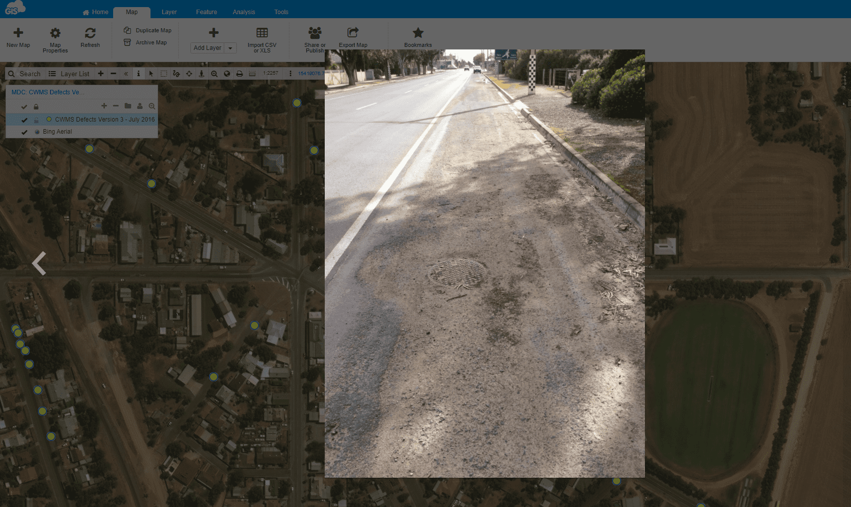
Here is an example of a Road Pavement Inspection form within the Mobile Data Collection (MDC) application.

As you can see, the survey is clean, with easy to select options for accurate data collection. The preset data options have saved the Council staff a lot of time on the quality assessment part of the workflow.
Staff can be confident the data was correctly entered in the field.
The ability to add photos has made a huge difference. Prior workflows required attaching the photos to the data points while trying to remember which photo was associated with which data point. The MDC removed the need to write down photo names and the ObjectID’s of the data collected.
The initial effort of the project was to locate issues throughout the service area.
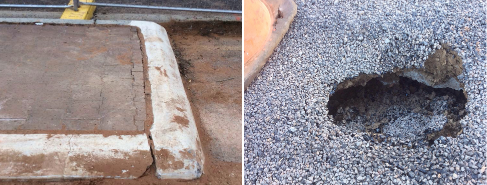
Issues like cracks in the sidewalks and potholes in crucial roadways were problems that needed addressing. The data inventory and assessment of the Council area collected these problems using the MDC application on Council staff’s smartphones.
There was no more need for heavy external data collectors. Any IOS or Android device with the application could collect the information.
With the ability to work offline, Council staff could continue collecting field data if they lost an internet connection. They simply synced the data once they regained internet access and updated the source data.
Since the initial road infrastructure assessment, the Council has changed the project’s focus. They now actively collect road data on an as-needed basis. Field crews can capture new data points as they cross their paths.
This gives the Council the information needed for properly maintaining their roads and staying ahead of citizen reports.
Road Sign Inventory using GIS Cloud
This has been another significant project for the Council. The Council, following its mission to “Provide a safe, healthy and sustainable environment for our growing community, business, and visitors, by providing quality services, infrastructure and facilities”, took the need to improve the road sign inventory seriously.
A road sign inventory was proposed to follow the guidelines for traffic devices on Council roadways.
Using MDC, the Council could deploy multiple staff members to the field to collect the existing traffic sign inventory. The road inventory data, using GIS Cloud solutions, allowed for editing by multiple users at one time.
While the team was collecting information from the field, another person was able to analyze the data in real time from the desktop at the office.
With an up to date road sign inventory, the Council has been able to address the damaged signs and those that were out of compliance with the Asset Management System and Manual of Uniform Traffic Devices. Creating work orders for the necessary changes was easy.
Using GIS Cloud again, custom reports were generated in the software and exported as PDFs. The custom reports pulled data directly from the information captured in the field, including the photos.
The new road signs were captured and photographed as the work order changes were completed.
The inventory has allowed the Council to properly budget and plan for future road signage repairs and improvements as they become necessary.
Conclusion
With GIS Cloud’s online GIS solutions, the Adelaine Plains Council was able to efficiently meet the important transportation needs of those who live there. By understanding the current situation quickly, they were able to identify and strategically schedule the road work maintenance and signage improvements.
GIS Cloud has been a proud partner to the Adelaine Plains Council for the past eight years and is excited to see how else they can support them. The Council may be small, but they have proven to have a great understanding of the power of GIS.
If your municipality could benefit from a similar workflow, explore our full suite of online GIS solutions by signing up for a 14-day trial. If you have any questions, our GIS Cloud solution consultants are ready to answer your questions and support your efforts.